

DroneViewer - IT solutions and workflows for your 3D aerial data & scans
Process. Visualize. Measure. Settle accounts. Communicate.
With DroneViewer, you can bring high-resolution, georeferenced 3D building models and orthophoto views directly into the browser and make them available to your customers in a cloud-based workspace with your own branding. Whether roof, façade or terrain: with just a few clicks, you or your customers can record areas, document damage, generate reports and (invoice) offers. You are the master of your data, determine the range of functions - and can also receive individual features and workflows for your business process on request.
Arrange a demo nowIdeal for
- Drone flyer
- Housing associations
- Project developer
- Solar, roof & facade trade
Target groups & areas of application
For everyone who works with buildings - smarter.
- Drone flyer
Upload 3D models, link projects, strengthen customer loyalty
- Housing companies
Documenting conditions, preparing renovations, recognizing PV potential
- Project developer
- Solar installers & roofers
Reliably evaluate pitches, roof shapes & obstacles
- Facade craftsmanship
Quickly record areas, calculate offers, plan measures
Demo
Test the DroneViewer demo here
Note: This interactive 3D demonstration is optimized for viewing in landscape format. Please rotate your mobile device for the best experience.
To the demo "3D-Viewer infrastructure planning"Digital measurement & analysis
More than just a viewer - your central work platform
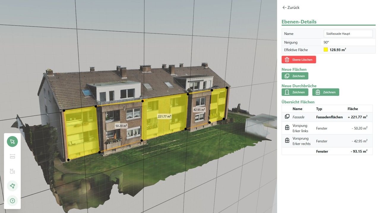
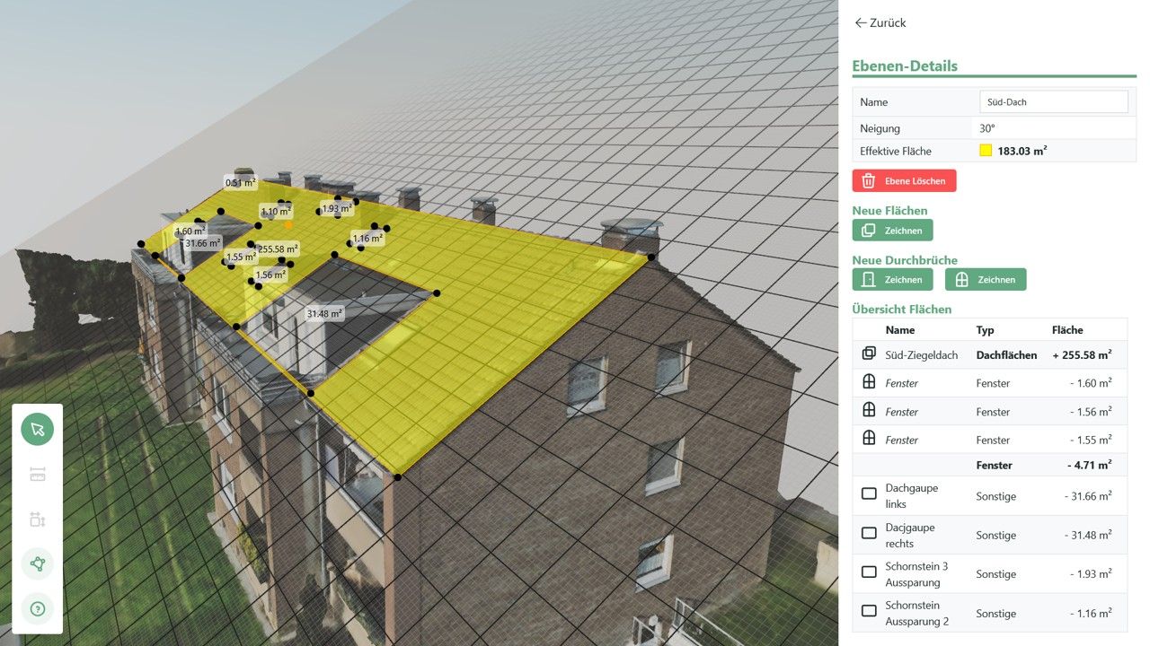
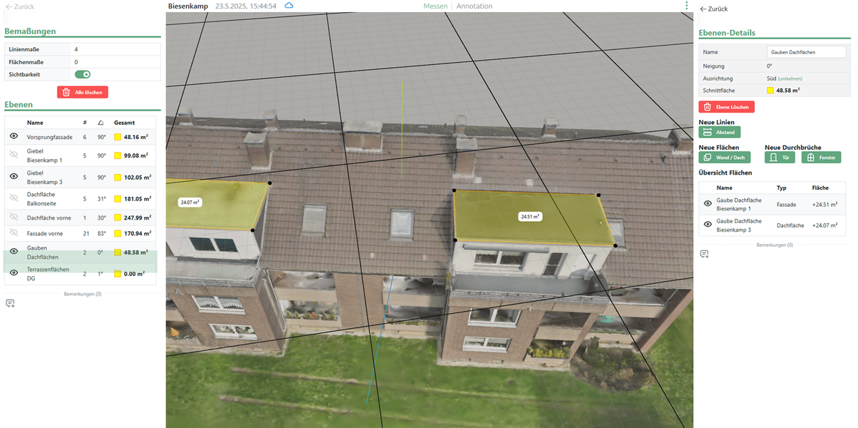
Set working plane instead of curving surface
Precisely capture facades and roofs with just three points
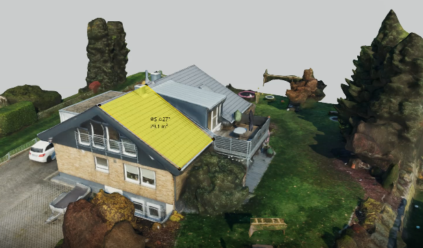
Exact dimensions
Lengths, areas, volumes, inclinations
Smart tools
Mapping, annotating, marking, damage numbering
View and edit 3D models directly in the browser
Damage analysis & thermal insulation
Classify, document, export
The working level - a real USP
Instead of laboriously measuring on crooked surfaces, you can define a working plane with just a few clicks - e.g. on a façade or a roof. Windows, doors or routes are automatically projected onto it. Fast, accurate and directly usable for planning, quotations or reports.
FAQ's about DroneViewer
Questions and answers
What is DroneViewer?
DroneViewer is a web app that can be used to view, measure and share 3D drone models of buildings.
Do I have to install software?
No. Everything runs directly in the browser - no installation necessary.
How accurate are the measurements?
The measurement accuracy depends on the drone scan - as a rule, the deviation is in the centimeter range.
Can I save the data permanently?
Yes, all measurements and comments can be saved in the project and called up or added to later.
How do I share a project with others?
Simply by project link - without login for the recipient, password-protected if desired.
Can DroneViewer be integrated into my system?
Yes, there is an API that can be used to automate uploads, material data or project links.