


Efficiently Documenting and Evaluating the Building Stock
DroneViewer for Housing Cooperatives & Property Managers
Background
Focus on Challenges
Renovations, maintenance, energy efficiency, and increasing documentation requirements—housing cooperatives and property managers are under a lot of pressure. With DroneViewer, you can document building conditions efficiently, transparently, and digitally.
Your Benefits
Your Benefits with DroneViewer
- Building Data Available Centrally
- 3D models right in your browser—no software required
- Area and Volume Calculations for Roofs and Facades
- Analyze thermal insulation, document damage
- PDF reports for bids, insurance, or internal planning
Inventory File
The damage is located where it occurs
Today, the documentation is stored in three separate locations: photos from the site visit, a spreadsheet listing trades and costs, and a plan in the archive. The photo shows the crack, but not the location. The spreadsheet lists the location, but not the condition. DroneViewer maps both to the same coordinate in the building model: a damage entry with category, photo, and date.
Comparison Over Time Rather Than a Snapshot
Each aerial survey is dated and stored in the same project. You open the latest survey next to today’s and see whether a crack has changed. When deciding whether to renovate, it’s the overall trend that matters, not a single image. A single scan is forgotten after two years. A series of snapshots over time within the same project remains accessible, even if the colleagues from back then are no longer with the company.
No on-site visit, no installation
Property management, structural engineers, and insurance companies can all access the same location via a project link in their browser. An external auditor does not need an account or special software to do so.
Sample Project
This is what you'll see when you open a facade in your browser
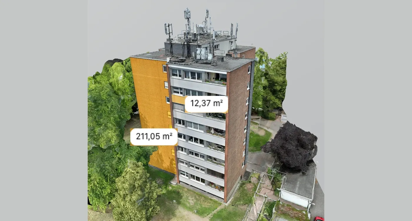
Aerial Survey of a Structure: 3D Model with Damage Mapping and Measurement Tools.
Is your network blocking the embedded demo? Open the demo in a new tab
Note: This interactive 3D demonstration is designed for landscape orientation. Please rotate your mobile device.
About the "3D Viewer for Infrastructure Planning" DemoVote
Three trades, one model, one foundation
The service provider has the professional software. Decisions are made by people who don’t have this software: property management companies, contractors, appraisers, and insurance companies. That’s exactly where coordination breaks down today.
How are the quantities included in the bid?
You create a working plane on the facade and take measurements on it. You subtract the areas of windows, doors, and balconies. What remains is the area that the trade actually works on, which serves as the figure for the scope of work.
Does the contractor need to install something?
No. The company opens the project link in a browser. A model from an aerial survey contains a large amount of data, and no one in the workflow wants to download it or open it on a workstation. That’s exactly what this eliminates.
How soon will the decision be made?
Three contractors submit bids based on the same criteria, without the need for three on-site visits. Any questions are posted as comments on the project document, rather than spread across five email threads. This shortens the time it takes to award the contract.
DroneViewer does not replace any program in your workflow. The point cloud is still generated in your service provider’s photogrammetry software, and your data is exported from the viewer. In between lies the part that no one currently addresses: a shared view of the same component among all stakeholders.
Point Cloud and Photogrammetry
- LAS
- LAZ
- E57
- OBJ
- Cesium 3D Tiles
- GeoTIFF
- DXF
CAD and BIM
- IFC
- Revit
- JT
- STEP
Your service provider delivers whatever its software generates. Point clouds and photogrammetry data go directly into the viewer. CAD and BIM data are added via the CAD/BIM module. The data is exported using the same open formats, so your data remains readable even without us.
How It Works
Here's how it works
You don't need your own drone pilot or your own analysis software. It takes four steps from flight to report, and three of them are done in the browser.
- Perform a scan (e.g., using a drone)
- Upload or link a 3D model
- Plan actions, mark damage, export tasks
- Share with partners, construction managers, or insurance companies
Your Processes
Ideal for Your Processes
The viewer really comes into its own in situations where, today, an on-site visit, a photo folder, and a spreadsheet are handled separately.
Condition Documentation Before and After Renovation
Bidding Documents with Images & Dimensions
Energy and Subsidy Projects (e.g., PV Suitability, Thermal Insulation Analysis)
Portfolio Dashboard & Progress Reports
Next Step
We'll show you how the viewer works using a building from your portfolio
Free and with no obligation. A 15- to 30-minute consultation with a suitable expert. Response within 24 hours.