
Your own instance. We host it; you retain control.
DroneViewer for Municipalities, Government Agencies, and Infrastructure Operators
Municipalities & Government Agencies
Operating Model & Data Sovereignty
A Dedicated Instance Instead of a New IT Project
You will receive your own instance, operated by 3DIT, which is organizationally and technically separate from other customers. You can work within it as if it were your own infrastructure, without tying up capacity at your own facility. Shared operation and on-premises deployment in your own data center are also available as options.
Hosted on a long-term basis, not just until the end of the project
Scans, models, and documentation remain accessible for years. Each new flight survey is added as an additional point in time, rather than replacing the previous one.
Compatible with various scan and drone data, regardless of manufacturer
Point clouds, photogrammetry, and CAD/BIM data are all consolidated in a single viewer. The data remains independent of who performed the flight and which software was used for processing.
Accessible to everyone involved
Access is via the browser, with no installation or training required. External auditors and other stakeholders can, if desired, be granted read-only access—even without any system access at all.
Traceability
Results Instead of a Black Box
DroneViewer runs as a plugin-free Web 3D viewer directly in the browser. No installation is required for you or for external inspectors. Conditions can be recorded, measured, annotated, and documented in a traceable way over time.
Suitability Assessment
What Matters in a Suitability Assessment
- Plugin-free Web 3D viewer; no client setup required
- Open data formats instead of siloed solutions
- Granular role and permissions model, including view-only access
- Sharing with third parties is possible even without any system access
Documented in the model
One damage, one entry, one record
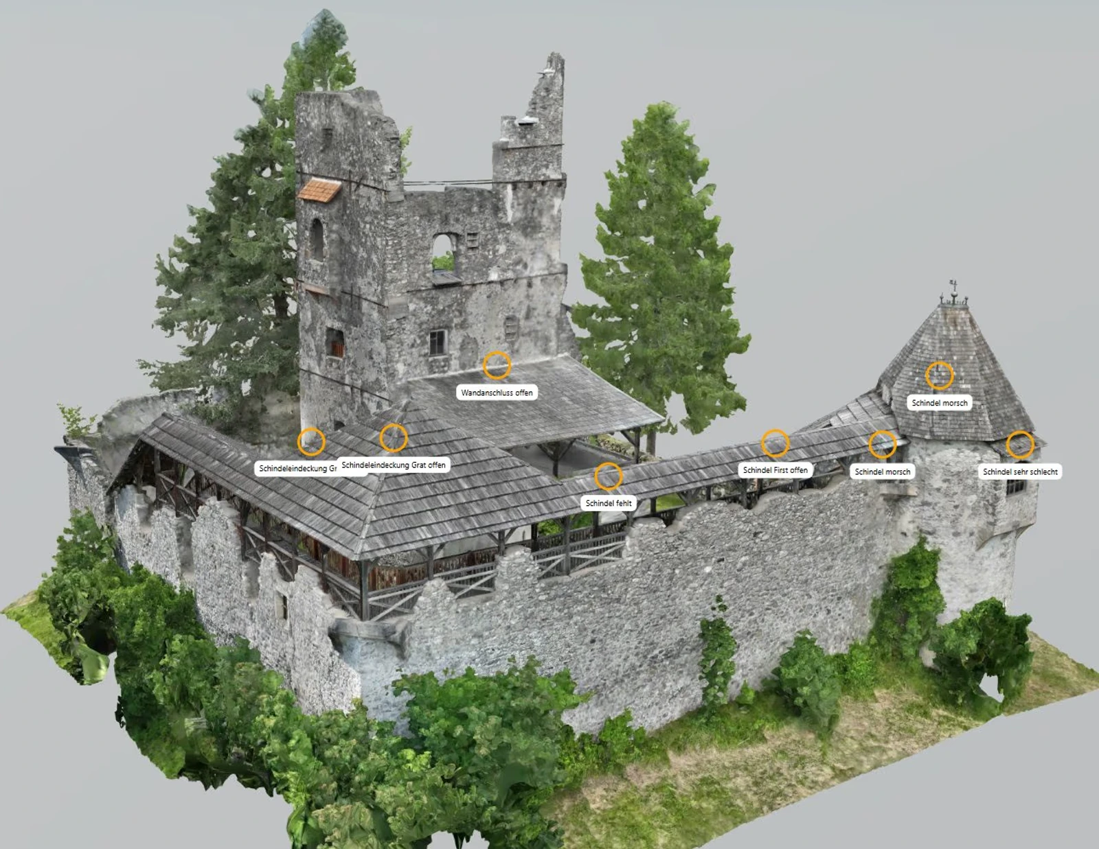
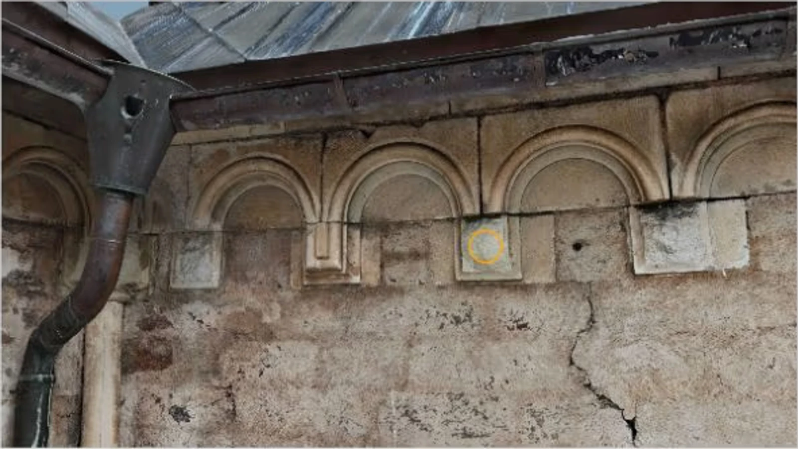
A defect or component is marked directly in the model, along with a photo, description, and timestamp. The entry remains at its coordinates within the structure and can be accessed at any time.
Specification
What DroneViewer Brings to Your Statement of Work
Tenders involving 3D, point clouds, and geodata share core requirements across industries. DroneViewer and Govie Viewer technology address these requirements as follows:
Access and Data
- Plugin-free web access
- RFP documents in the 3D and geospatial data fields frequently specify browser-only access as a minimum requirement. DroneViewer meets this requirement without any client setup, even for external auditors.
- Georeferencing According to the Standard
- Our processing chain is based on GDAL and PROJ. It covers the coordinate reference systems commonly used in requests for proposals: ETRS89/UTM (EPSG:25832, 25833), WGS84 (EPSG:4326), Web Mercator (EPSG:3857), LAEA Europe (EPSG:3035), and DHDN/Gauss-Krüger (EPSG:31466–31469) for historical cadastral data. We can set up additional reference systems upon request.
- Open exchange formats for capture and delivery
- The complete list of supported formats can be found in the “Govie Viewer Technology” section below.
- Accuracy from Data Collection
- The analysis is accurate to the centimeter, to the extent that the data collection allows. The level of accuracy for a specific project depends on the hardware used and is tailored to the project.
Working with the Model
- More Than Just a Point Cloud: Structured Information
- Damage and objects can be documented directly in the model as separate, categorized entries with photos and history. This transforms a simple 3D representation into a transparent information management system.
- Measuring and Analyzing in the Viewer
- Distance, area, volume, and slope can be measured directly in the browser, without the need for special software. Cross-sections and elevation profiles are also available.
- Time Series for Construction Supervision and Preservation of Evidence
- A project can contain multiple dated scans. Different points in time can be compared directly, and measurements and annotations are preserved across all time points. This serves as the basis for creating your own internal documentation of construction progress.
- Vendor-Neutral Property Tours for Real Estate Marketing
- Virtual 360-degree tours, including 3D dollhouse views, can be created from equirectangular images taken with cameras from any manufacturer. This ensures that the marketing of municipal real estate is not tied to a specific imaging device or cloud platform.
Access and Sharing
- A Roles-and-Privileges Model Instead of an All-or-Nothing Approach
- A two-tier role-based model and a three-tier authorization system control access, down to the level of view-only access. This is the granular control that government agencies and security-sensitive clients expect.
- Controlled Sharing Without System Access
- Sharing links and the offline export package are described in the “Sharing Without System Access” section below.
Integration and Operation
- Documented REST API
- A documented REST API integrates DroneViewer with existing business applications and portals. It provides the foundation for further system integration.
- Configurable without development
- The feature set can be customized for each customer using feature flags, without requiring any development work. A standalone no-code editor for custom categories is not currently part of the product.
- Operations According to Your Specifications
- The three operating models are described in the “Operating Models” section below. Certifications and SLAs are coordinated on a project-by-project basis.
- Clear Data Sovereignty
- Usage rights and the handling of your data are governed by a contract for each project. Open export formats ensure your data remains portable, without being locked into a proprietary format.
Operating Models
Operating Models: You Decide Where and How to Host
Neither "the cloud for everyone" nor a setup that requires your own IT resources: You choose the model that fits your infrastructure and requirements.
Split Instance
Standard operation, hosted in compliance with the GDPR—the fastest way to get started without your own infrastructure.
Dedicated Instance (Single Tenant)
A dedicated instance operated by 3DIT—separate from other customers both organizationally and technically.
On-premises
Operations at the client's data center—full control over infrastructure and data storage.
Modules & Data Sources
Govie Viewer Technology: Two Modules for Your Data Sources
The Govie Viewer technology uses two modules to handle point cloud, photogrammetry, and CAD/BIM data.
DroneViewer Module
- LAS
- LAZ
- E57
- OBJ
- Cesium 3D Tiles
- GeoTIFF
- DXF
CAD/BIM Module
- IFC
- Revit
- JT
- STEP
Sharing & Export
Sharing Without Any System Access
Projects can be exported as standalone, executable packages and shared—ideal when external auditors or partners should not or may not access your system.
Funding Landscape
Smart City as a Building Block of Your Funding Strategy
The federal government, Germany’s states, and the EU support municipal digitization and Smart City strategies through various programs. Funding is generally provided for a municipality’s overall strategy, not for the isolated purchase of individual software. Building and infrastructure documentation can form part of such a strategy, with DroneViewer serving as the contracted software partner. We would be happy to discuss which funding options may currently suit your municipality.
Contact
Next Step
Free and with no obligation. A 15- to 30-minute consultation with a suitable expert. Response within 24 hours.